



Live Climb Reports
Follow the climb from home, as it happens
While your climber is on Kilimanjaro, their guide reports from the mountain each time the group moves: as they set off, at lunch and when they reach camp, with photos. Between reports, a live map shows where the group is likely to be, with the weather at their height.
Anyone with the link can follow along: partners, parents, children, friends and colleagues. No app and no account.
- 2 to 5Reports a day
- LiveEstimated position
- PhotosFrom the guide
- WeatherAt the group’s height
Finding your climber
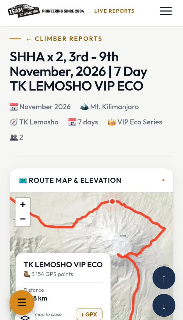
Every climb has its own page on Live Climb Reports. There are two easy ways to find the right one.
By the dates
Each climb is listed with its dates, route and length. We usually have only a few climbs on the mountain at any one time, so the dates alone are often enough.
By the climb code
Each group has a four-letter code, usually the first two letters of the first name and surname of the person who made the booking, followed by the number of climbers. Ask your climber for theirs before they fly.
A day on the mountain, from home
Guides post each time the group moves, so a typical day brings two to five reports. Sometimes a report is written up and posted a little after the moment it describes, when signal allows.
Setting off
How everyone slept, breakfast, and the day’s plan as the group leaves camp.
On the trail
Sometimes a quick update from a viewpoint or a rest stop.
Halfway
Progress so far and how the group is coping with the height.
Safe in camp
Arrival at camp, the height, how each climber is doing, often with photos.
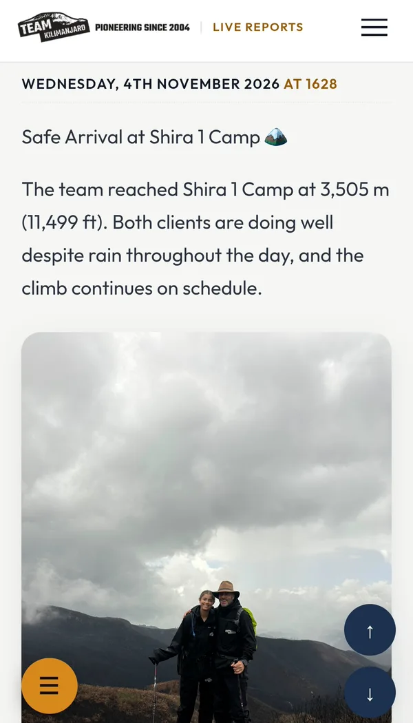
Safe Arrival at Shira 1 Camp 🏔️
The team reached Shira 1 Camp at 3,505 m (11,499 ft). Both clients are doing well despite rain throughout the day, and the climb continues on schedule.
A real report from the mountain, as families saw itWhat you will see
Each climb’s page brings together the guide’s reports, a map of the route and where the group is likely to be, and the weather up there.
The live map
Where they are, right now
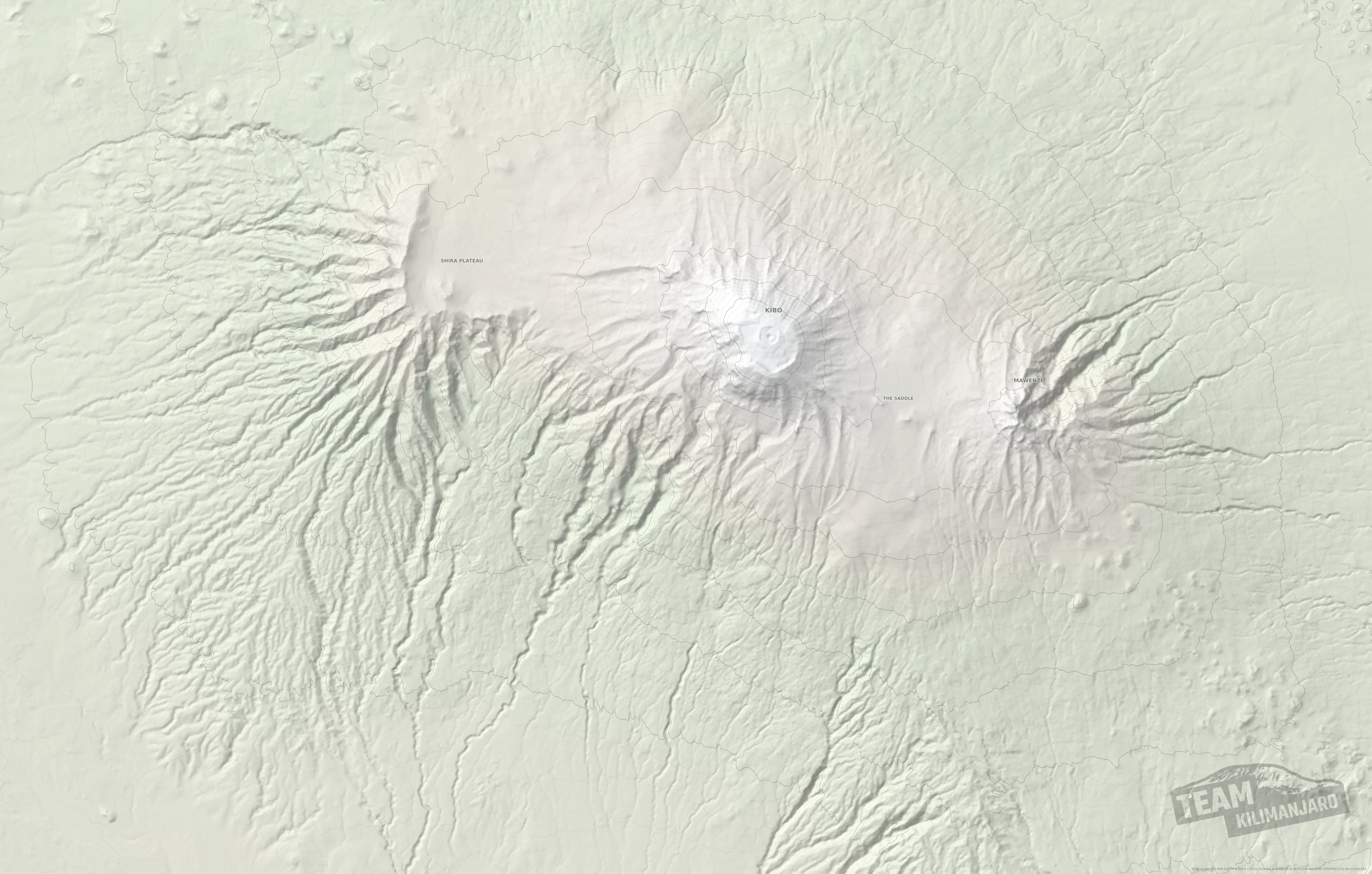
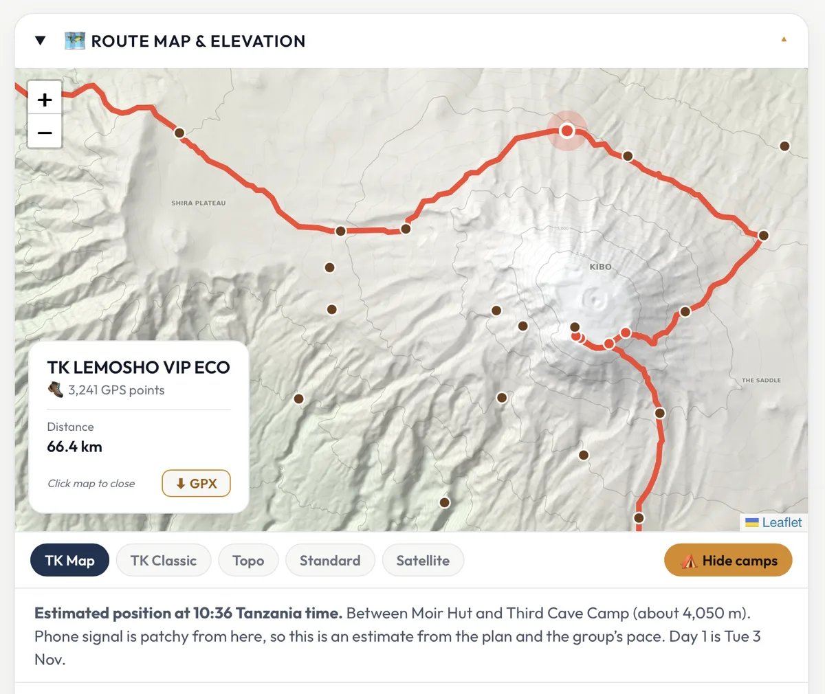
The whole route is drawn on our own map of Kilimanjaro, from our GPS tracks. A red dot shows where the group is likely to be at this moment, worked out from the day’s plan and the group’s pace, and it moves on through the day.
- Every camp on the mountain, at a tap
- Five map styles, from our own map to satellite
- Download the route as a GPX file
Weather and height
The weather where they are, not in the town below
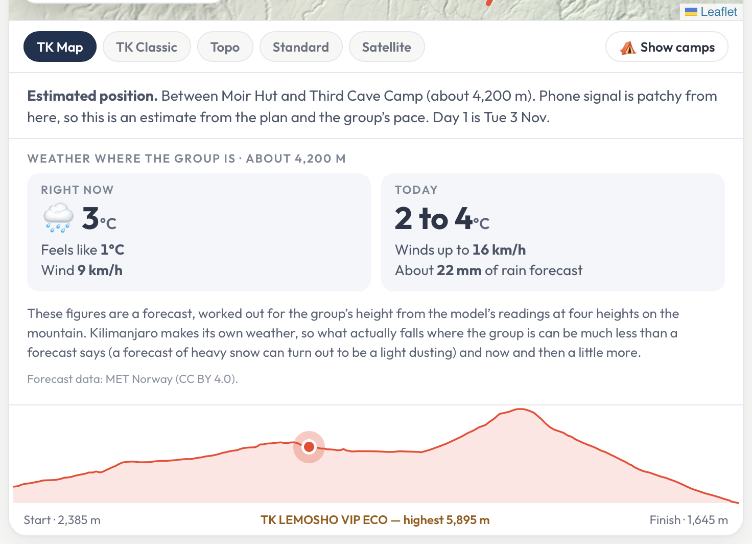
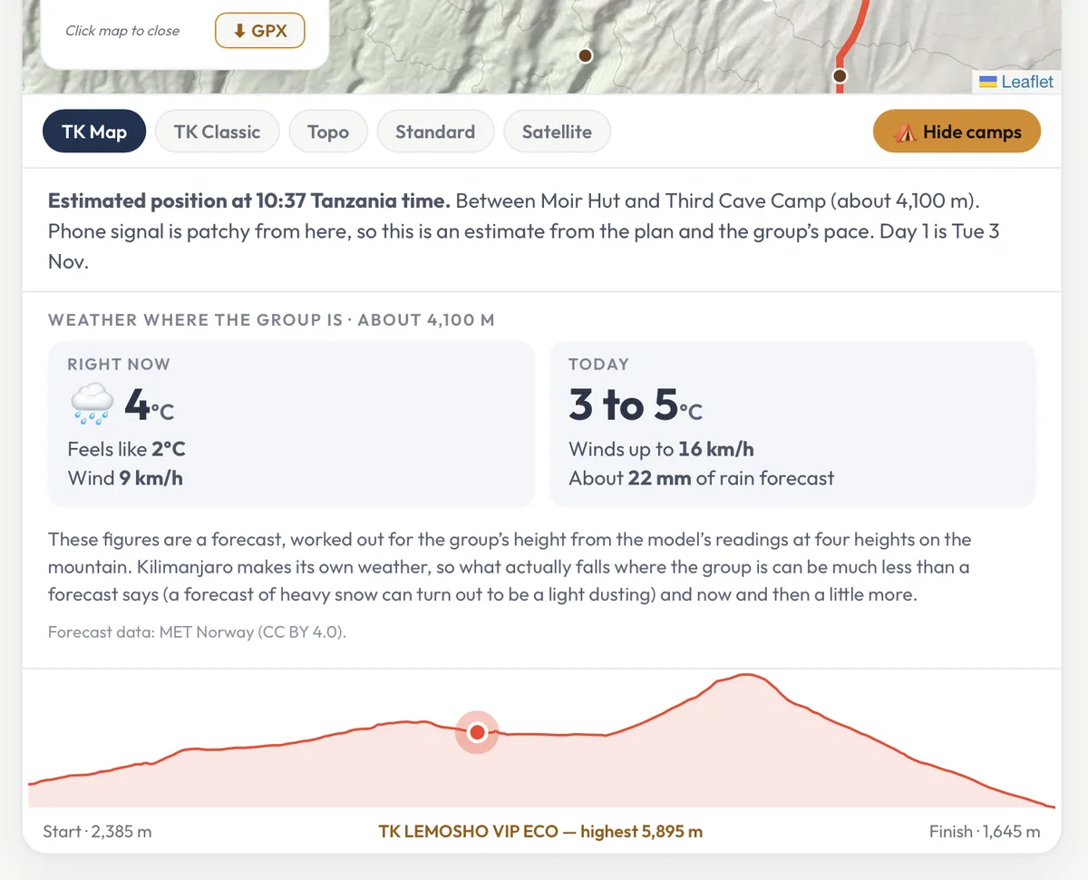
The forecast is worked out for the group’s height, so you see what it is like up there now and through the day: temperature, how cold it feels, wind and rain. Kilimanjaro makes its own weather, so what actually falls is often much less than a forecast says.
- The climb’s whole profile, with the group’s place on it
- How high they are, and how far there is to go
The guide’s reports
Day by day, in words and pictures
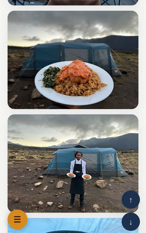
Reports are grouped by day of the climb, with the guide’s photos and short videos: the trail, the camps, the meals, and the climbers themselves. Jump straight to any day, or scroll through the climb from the beginning.
- From the night before the climb to the last day
- Works just as well on a phone as on a computer
Between reports
The dot keeps moving, even out of signal
Kilimanjaro has phone signal on much of the mountain, but not all of it. When a group is out of signal, the reports pause, but the map does not: the estimated position carries on along the day’s route at the group’s pace, from the last report to the next camp.
Each estimate says plainly that it is one, with the time in Tanzania, so you always know what you are looking at.
Estimated position at 10:36 Tanzania time. Between Moir Hut and Third Cave Camp (about 4,050 m). Phone signal is patchy from here, so this is an estimate from the plan and the group’s pace.
When the reports go quiet
A quiet spell almost always means no signal, not a problem. It helps to know where to expect one.
On Lemosho and Rongai there is usually no signal at all for the first two days. On Lemosho it returns near the Shira ridge, at about 3,475 m, and is patchy from there.
Now and then the network itself goes down on the mountain, occasionally for a day or more. The guide reports again as soon as it returns.
If you are worried, contact us. Our chief guides report to our expedition coordinator in Arusha from the mountain every day.
Live Climb Reports are one of the things we are proudest of, but they depend on the phone network and the mountain, so we can’t promise a report or photo at any particular time.
Questions families ask
Do I need an app or an account?
No. Each climb’s page opens in any web browser.
Bookmark the page or save it to your phone’s home screen, and come back to it as often as you like during the climb.
How do I know which climb is theirs?
By the dates, or by the climb code.
The code is usually the first two letters of the first name and surname of the person who made the booking, then the number of climbers: John Doe and five friends would be JODO x 6. Ask your climber for theirs before they leave.
Why has the dot moved when there’s no new report?
It is an estimate, and it moves on its own.
The position is worked out from the day’s plan and the group’s pace, so it keeps moving between reports and where there is no signal. The note under the map always says when it is an estimate.
Why don’t you give climbers a GPS tracker, such as a Garmin inReach or a SPOT?
We have tried them, and on Kilimanjaro they cause more worry than they save.
How they work. A tracker does two separate jobs. Its GPS receiver only listens: it picks up timing signals from the GPS satellites and works out where it is, but it cannot tell anyone. A second radio then sends that position, a message of a few words, up to a communications satellite: Iridium for the inReach, Globalstar for the SPOT. The satellite passes it down to a ground station, and from there it reaches the family’s map over the internet, usually every ten minutes or so. It does not use the phone network at all.
Why the positions come and go. Both jobs need a clear view of a wide patch of sky. Under the forest, in steep valleys and beneath the great cliffs of the mountain, much of the sky is hidden, and in bad weather a tracker can go a long while without sending a position at all.
Why the tracks have spikes. A GPS receiver works out its position from the time each satellite’s signal takes to arrive. Beside a cliff, some signals arrive by bouncing off the rock, a little late, and a valley wall leaves only a few satellites in view, often all on one side of the sky. The receiver’s answer can then jump hundreds of metres, before it settles back when the view opens up again. On a map this looks alarming to anyone not used to reading raw GPS: a sudden line off the trail and straight back, across cliffs and ravines, as if the climber had wandered off in a straight line over everything in the way. It is the receiver correcting itself, not the climber.
Why we don’t need one. Our routes are fixed, and planned to be as efficient as possible, so we know where every group walks. A track from each climb would be the same line as the one on our map, only with the errors added. The map draws that line from our own GPS tracks, cleaned of those errors, and the estimated position follows it through the day. Tracking apps on a phone, meanwhile, depend on the same phone signal as the guide’s reports, so they add nothing either.
A report describes something from a while ago. Why?
It was posted when the signal allowed.
Guides sometimes write a report and post it a little later, when they have signal or a moment to spare. Reports appear under the day they describe.
Can I see climbs that have finished?
Yes. Finished climbs stay on Live Climb Reports.
They are a good way to see what a climb with us is really like, day by day. Here is one: an eight-day TK Lemosho climb in the VIP Eco series, in September 2026.
See who’s on the mountain now
Open Live Climb Reports to follow today’s climbs, or browse finished ones to see a climb with us from start to finish.
Open Live Climb Reports