



The Machame route
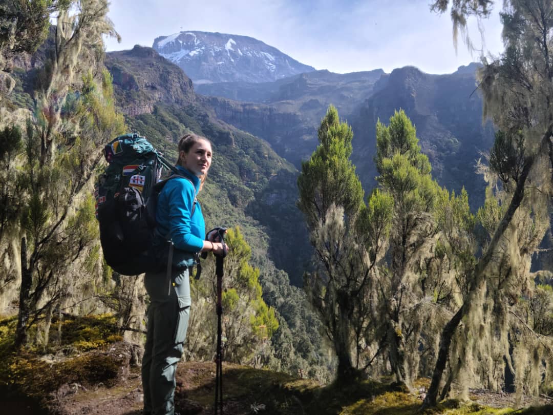
Kilimanjaro’s most popular route: a varied, beautiful climb from the rainforest on the southern side onto the Shira Plateau. We run it two ways, as the standard Machame route and as TK Machame, our own variation round the quiet northern side of the mountain.
The standard route crosses beneath the southern glaciers by way of the Lava Tower, Barranco and Karanga, and summits from Barafu. TK Machame climbs towards the Lava Tower too, then heads north to Moir Hut, follows the northern circuit around Kibo and summits from School Hut, away from the busy southern camps.
- 56.7–70.5 kmGate to gate
- 6 to 8 daysOn the mountain
- 1,820 mMachame Gate
- MwekaDescent route
Two ways to climb Machame
Both start at Machame Gate and climb through the forest to the Shira Plateau. On day three they part near the Lava Tower: the standard route drops to Barranco, TK Machame heads north to Moir Hut.
The standard Machame route
On day three the route climbs to the Lava Tower at 4,645 m and comes back down to sleep at Barranco, 3,975 m, which helps acclimatisation. It has a cost, though. It is a long, hard day close to the summit bid, and the next day loses about 340 m into the Karanga Valley, all of which must be climbed again before Barafu. Acclimatisation always has to be balanced against the stamina you will need for summit night, so we run Machame to protect that reserve: early starts, a steady pace and, on seven days, a full rest day at Barafu. The summit is approached up a ridge from Barafu rather than a loose scree slope, which is easier going in the dark.
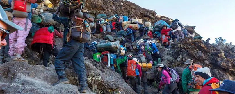
Its two drawbacks are well known. Guidebooks make much of two scrambles, below the Shira Plateau and on the Barranco Wall, though neither is as difficult as it is often made out. And the route is busy: in the northern summer, Barranco and Barafu are among the most crowded camps on the mountain. We soften this by leaving each camp much earlier than other groups, which also gives better weather, as cloud usually rolls in around lunchtime.
Local accounts say the Italian Balletto found the route by throwing meat for his dog and following where it walked through the forest. Probably a myth, but a nice story; the park did name a glacier after him.
TK Machame, our own variation
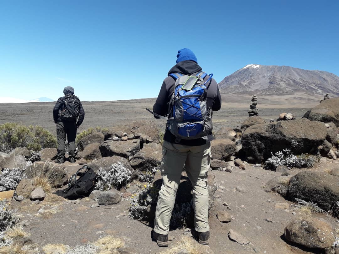
TK Machame keeps Machame’s convenient start and its first two days, then leaves the southern circuit where it is busiest. From the Lava Tower it heads north and down to sleep at Moir Hut, joining TK Lemosho for the rest of the climb: the quiet northern side of the mountain, a climb-high, sleep-low day on the way to Pofu, and a steady rise to School Hut with nothing lost.
Acclimatisation always has to be balanced against the stamina you will need for summit night. TK Machame gains the acclimatisation on gentler northern ground and reaches high camp without the Karanga Valley’s lost height, so you start summit night with your strength intact. It takes seven or eight days and costs the same as Machame for the same number of days.
| Route | Gate to gate | Days | From day three | Climb high, sleep low | Height lost and climbed again | Last camp | Summit approach | Crowding | Descent |
|---|---|---|---|---|---|---|---|---|---|
| TK MachameTK route | 70.5 km | 7 or 8 | North to Moir Hut and the quiet northern circuit | 485 m, Lava Tower to Moir Hut | None | School Hut4,715 m | From School Hut, on the quiet north-east side | Busy for two days, then quiet | Mweka |
| Machame | 56.7 km | 6 or 7 | The Lava Tower, Barranco and Barafu | 670 m at the Lava TowerClose to the summit bid | About 340 mThe day before summit night | Barafu4,673 m | Stella Point, from Barafu | Busy, especially in the northern summer | Mweka |
Swipe sideways to see every column. Tap i for more detail.
The shape of the route
Drawn from our own GPS tracks. Choose a route to see its profile.
- Machame Gate1,820 m
- Machame Camp3,025 m
- Shira Cave Camp3,835 m
- Lava Tower4,645 m
- Moir Hut4,160 m
- Pofu3,990 m
- Third Cave3,940 m
- School Hut4,715 m
- Uhuru Peak5,895 m
- Millennium3,800 m
- Mweka Gate1,645 m
- Machame Gate1,820 m
- Machame Camp3,025 m
- Shira Cave Camp3,835 m
- Lava Tower4,645 m
- Barranco3,975 m
- Karanga4,035 m
- Barafu4,673 m
- Uhuru Peak5,895 m
- Mweka Camp3,060 m
- Mweka Gate1,645 m
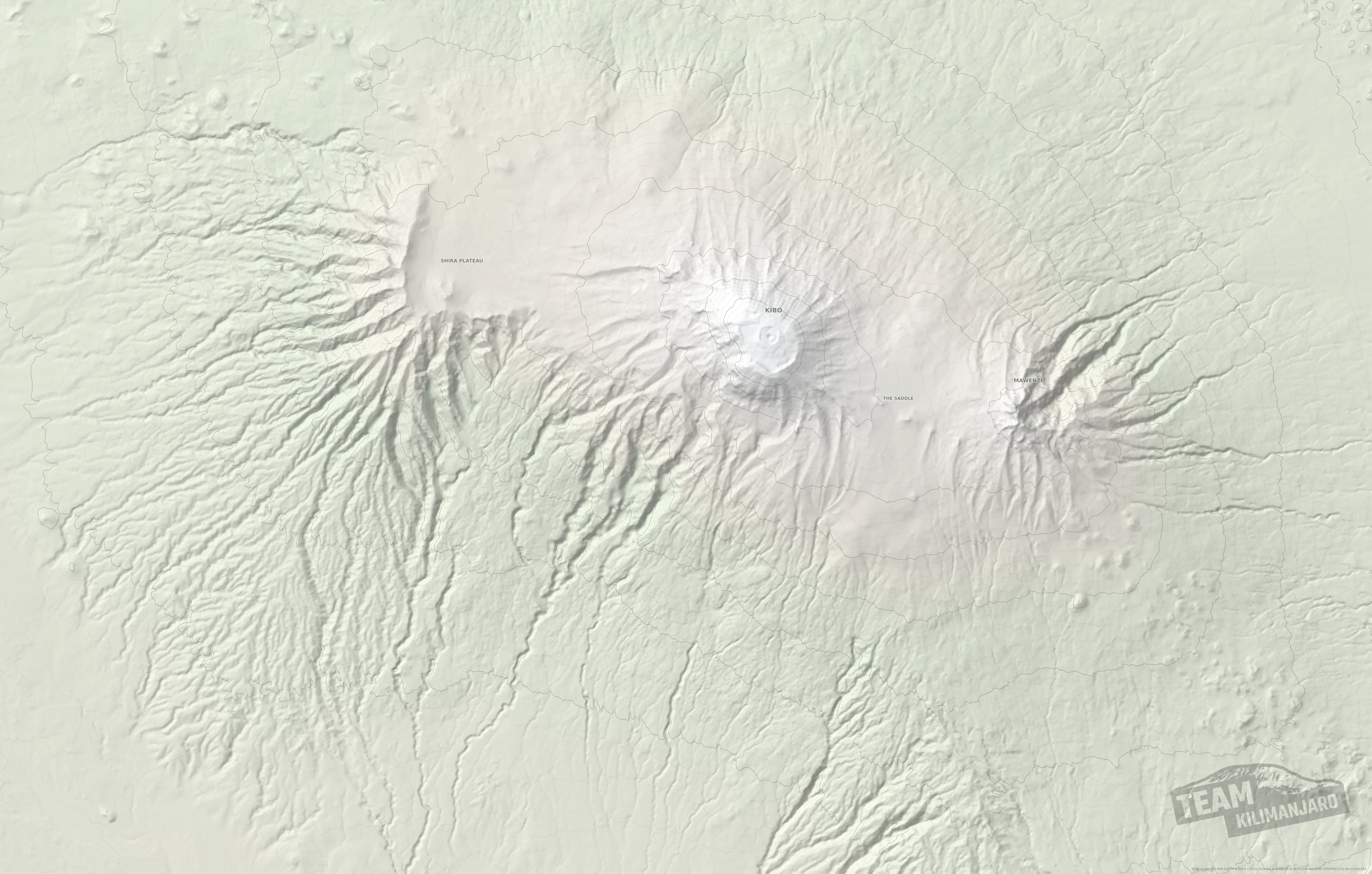
Machame route map
Both routes on our relief map of the mountain. They share the first two days and the climb towards the Lava Tower, then part. Tap a route’s name to hide or show it, and tap a line for its distance and downloads.
Day by day
Distances come from our GPS tracks. Your guide may vary the plan, as explained below.
- Day1
Machame Gate to Machame Camp
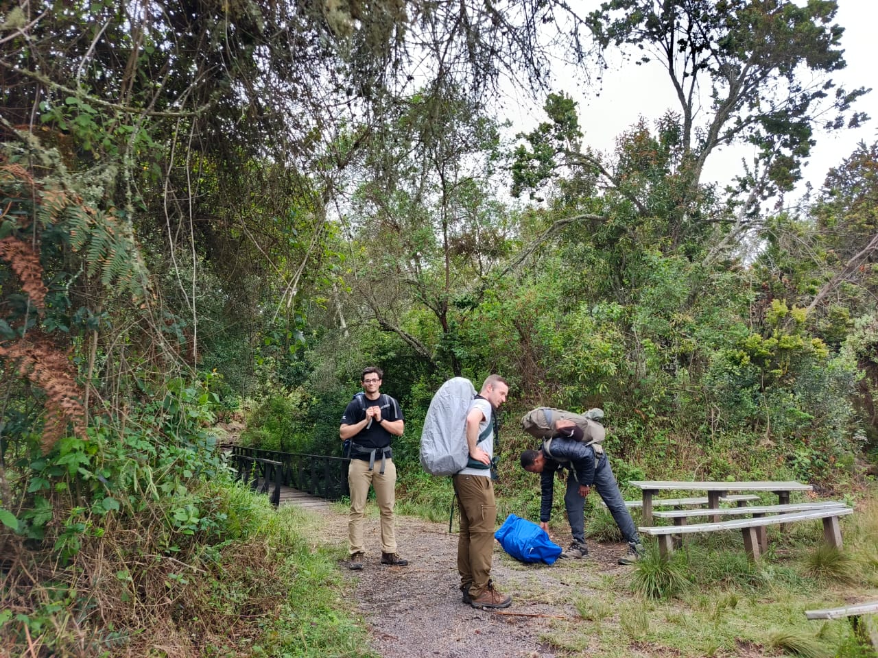
After registering at the gate, a steady climb of some 1,200 m through the rainforest on the southern side, while the porters carry the camp ahead of you. For two days you share the path with Machame climbers.
- Day2
Machame Camp to Shira Cave Camp
Out of the forest and up a steep ridge of giant heather onto the southern edge of the Shira Plateau. In the afternoon we usually walk a couple of hundred metres higher to help you sleep and acclimatise.
- Day3
Shira Cave Camp to Moir Hut, via the Lava Tower
Up towards the Lava Tower with the Machame climbers, then north, away from them, and down to sleep at Moir Hut, 485 m lower: climb high, sleep low. If the weather or the group’s acclimatisation calls for it, your guide may take the direct path across the plateau instead. At Moir Hut you join the TK Lemosho route, and from here the two are the same.
- Day4
Moir Hut to Pofu Camp
The day that makes the route. Onto the quiet northern side of Kibo, climbing to around 4,400 m before descending to sleep at Pofu, some 400 m lower: climb high, sleep low.
- Day5
Pofu Camp to Third Cave
An easy traverse at almost level height, with Mawenzi’s jagged peaks ahead. A gentle day that lets your body catch up.
- Day6
Third Cave to School Hut
A short, steady climb to the high camp, arriving early. Rest, an early meal and an early night.
- Day7
School Hut to Uhuru Peak, down to Millennium Camp
Summit night from the north-east, reaching the crater rim and Uhuru Peak around sunrise, then down the southern side to Millennium Camp.
- Day8
Millennium Camp to Mweka Gate
Down through heath and rainforest to the gate, where your transfer is waiting.
- Day1
Machame Gate to Machame Camp
After registering at the gate, a steady climb of some 1,200 m through the rainforest on the southern side, while the porters carry the camp ahead of you. For two days you share the path with Machame climbers.
- Day2
Machame Camp to Shira Cave Camp
Out of the forest and up a steep ridge of giant heather onto the southern edge of the Shira Plateau. In the afternoon we usually walk a couple of hundred metres higher to help you sleep and acclimatise.
- Day3
Shira Cave Camp to Moir Hut, via the Lava Tower
Up towards the Lava Tower with the Machame climbers, then north, away from them, and down to sleep at Moir Hut, 485 m lower: climb high, sleep low. If the weather or the group’s acclimatisation calls for it, your guide may take the direct path across the plateau instead. At Moir Hut you join the TK Lemosho route, and from here the two are the same.
- Day4
Moir Hut over the northern circuit to Third Cave
The long day that makes the seven-day route. Onto the quiet northern side of Kibo, climbing to around 4,400 m, past Pofu and on to sleep at Third Cave, some 440 m below the day’s high point: climb high, sleep low.
- Day5
Third Cave to School Hut
A short, steady climb to the high camp, arriving early. Rest, an early meal and an early night.
- Day6
School Hut to Uhuru Peak, down to Millennium Camp
Summit night from the north-east, reaching the crater rim and Uhuru Peak around sunrise, then down the southern side to Millennium Camp.
- Day7
Millennium Camp to Mweka Gate
Down through heath and rainforest to the gate, where your transfer is waiting.
Seven days or eight? The routes are identical except for Pofu Camp. On the eight-day climb you sleep at Pofu and walk to Third Cave the next morning. On the seven-day climb you continue past Pofu to Third Cave the same day, a long day of 15.6 km.
- Day1
Machame Gate to Machame Camp
After registering at the gate, a steady climb of some 1,200 m through the rainforest, while the porters carry the camp ahead of you. The last two hours can be tiring.
- Day2
Machame Camp to Shira Cave Camp
Out of the forest and up a steep ridge of giant heather, with one short scramble just before the southern edge of the Shira Plateau. A mild headache is normal today. In the afternoon we usually walk a couple of hundred metres higher to help you sleep and acclimatise; at sunset the view west over the plateau’s jagged rim is superb.
- Day3
Shira Cave Camp to Barranco, via the Lava Tower
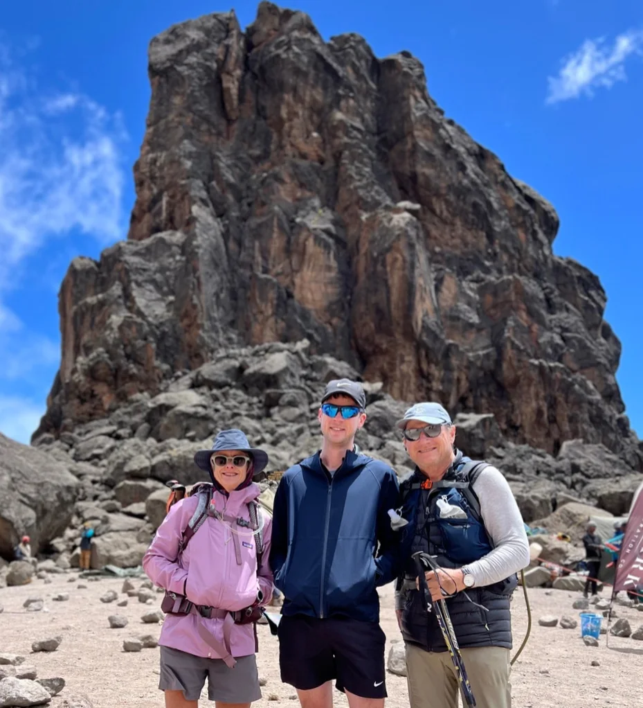
A hard day. Up to the foot of the Lava Tower for lunch, the highest point so far; in good weather your guide can take you to its top, at 4,688 m, for the views. Then down to sleep at Barranco, 670 m lower. Climbing high and sleeping lower helps you acclimatise, but it is a long day, so we keep the pace steady to save your strength for the days ahead.
- Day4
Barranco to Barafu, via Karanga
A long, tiring day. First the Barranco Wall, 245 m of scrambling, easier than it looks, with one stride around an outcrop of rock; if you are nervous of it, a member of our crew stands on the ledge below to guide your feet. Then three rises and falls to lunch at Karanga (4,035 m), and 640 m up to the high camp at Barafu.
- Day5
Barafu to Uhuru Peak, then Mweka Camp
Summit night starts around midnight, at the time your guide judges best for your pace: up the ridge to Stella Point (5,756 m) on the crater rim, ideally around sunrise, then about an hour more to Uhuru Peak. Back to Barafu for a rest and refreshments, then down to Mweka Camp, or to Millennium Camp (3,800 m) if your guide judges a shorter day will spare tired knees.
- Day6
Mweka Camp to Mweka Gate
Down through the rainforest to the gate, where you sign the summit register, then a short walk to meet our vehicle and the drive back to Arusha.
- Day1
Machame Gate to Machame Camp
After registering at the gate, a steady climb of some 1,200 m through the rainforest, while the porters carry the camp ahead of you. The last two hours can be tiring.
- Day2
Machame Camp to Shira Cave Camp
Out of the forest and up a steep ridge of giant heather, with one short scramble just before the southern edge of the Shira Plateau. A mild headache is normal today. In the afternoon we usually walk a couple of hundred metres higher to help you sleep and acclimatise; at sunset the view west over the plateau’s jagged rim is superb.
- Day3
Shira Cave Camp to Barranco, via the Lava Tower
A hard day. Up to the foot of the Lava Tower for lunch, the highest point so far; in good weather your guide can take you to its top, at 4,688 m, for the views. Then down to sleep at Barranco, 670 m lower. Climbing high and sleeping lower helps you acclimatise, but it is a long day, so we keep the pace steady to save your strength for the days ahead.
- Day4
Barranco to Barafu, via Karanga
A long, tiring day. First the Barranco Wall, 245 m of scrambling, easier than it looks, with one stride around an outcrop of rock; if you are nervous of it, a member of our crew stands on the ledge below to guide your feet. Then three rises and falls to lunch at Karanga (4,035 m), and 640 m up to the high camp at Barafu.
- Day5
Rest and acclimatisation at Barafu
A day to sleep, eat, drink and recover your reserves, with a short excursion, at your guide’s discretion, no higher than 5,000 m: enough to fine-tune your acclimatisation and see the ridge you will climb that night.
- Day6
Barafu to Uhuru Peak, then Mweka Camp
Summit night starts around midnight, at the time your guide judges best for your pace: up the ridge to Stella Point (5,756 m) on the crater rim, ideally around sunrise, then about an hour more to Uhuru Peak. Back to Barafu for a rest and refreshments, then down to Mweka Camp, or to Millennium Camp (3,800 m) if your guide judges a shorter day will spare tired knees.
- Day7
Mweka Camp to Mweka Gate
Down through the rainforest to the gate, where you sign the summit register, then a short walk to meet our vehicle and the drive back to Arusha.
How we run Machame
The route is the same for every operator. What differs is how the days are run, and your guide adjusts the plan on the mountain.
Early starts
We leave each camp well before most groups, ahead of the crowds and the cloud.
In bad weather the cloud typically rolls in around lunchtime, though it is perfectly possible to enjoy rain all day. Leaving early means quieter paths, the best of the views, and arriving at camp before the weather turns.
Acclimatisation walks
An extra climb above Shira Cave Camp for a better night’s sleep.
On the afternoon of day two we usually walk a couple of hundred metres above Shira Cave Camp and come back down to sleep. It helps you sleep better and acclimatise before the big day past the Lava Tower.
The Barranco Wall
One awkward step, and a member of our crew to help you over it.
The scramble looks daunting from below, but it is mostly a steep staircase of rock. There is one stride around an outcrop that looks precarious in photographs; if you are nervous of it, a member of our crew stands on the ledge underneath to guide your feet.
Barafu, or higher at Kosovo Camp?
Some climbers prefer to start summit night higher, at Kosovo Camp.
Kosovo Camp, above Barafu, shortens summit night. The park charges extra for it, so it changes the price: see Machame via Kosovo Camp below.
Would a quieter route suit you better?
Our own routes avoid the busy southern circuit.
If crowds matter to you, TK Machame, TK Lemosho and TK Rongai spend their last days on the quiet northern side of the mountain and summit from School Hut. Which route is best for you?
Add a night in the crater
Every route we run, Machame included, can be lengthened by one day to sleep inside the summit crater at Crater Camp, 5,725 m. This is our Excel Series, and it turns the summit into the start of a day and a half on the roof of Africa rather than a few minutes before the descent.
Our GPS track of the whole crater excursion, every option included: 9.8 km from Uhuru Peak to Stella Point.
- Summitday
Uhuru Peak, Furtwängler Point and down into the crater
From the summit we carry on about 200 m along the rim to Furtwängler Point, then drop into the crater to rest at Crater Camp. Climbers in good form walk to the top of the Western Breach, about 1.0 km there and back, to watch the sun set over Mount Meru, and explore the south face of the Furtwängler Glacier, which is shrinking fast and will not be there much longer.
- Craterday
The Reusch Ash Pit and the Northern Icefields
In the morning we climb to the rim of the Reusch Ash Pit and, if there is time, walk all the way round it. The strongest climbers also explore the Northern Icefields before finishing the circuit. Then back to Stella Point and down to Barafu.
Machame prices
TK Machame costs the same as Machame for the same number of days. Advantage series, our most popular level of support; per person in US dollars, depending on the size of your booking group.
TK Machame, 7 days
From
USD 2,523per person, group of 8
- Solo, joining a groupUSD 2,767
- Solo, private climbUSD 3,196
TK Machame, 8 days
From
USD 2,862per person, group of 8
- Solo, joining a groupUSD 3,129
- Solo, private climbUSD 3,587
Machame, 6 days
From
USD 2,198per person, group of 8
- Solo, joining a groupUSD 2,424
- Solo, private climbUSD 2,838
Machame, 7 days
From
USD 2,523per person, group of 8
- Solo, joining a groupUSD 2,767
- Solo, private climbUSD 3,196
Machame via Kosovo Camp
A popular variation that spends the last night before the summit at Kosovo Camp, above Barafu, so summit night starts higher and closer to the crater rim. Seven days on the mountain, with arrival the day before and departure the day after.
- Day1
Machame Gate to Machame Camp
After registering at the gate, a steady climb of some 1,200 m through the rainforest, while the porters carry the camp ahead of you. The last two hours can be tiring.
- Day2
Machame Camp to Shira Cave Camp
Out of the forest and up the steep ridge of giant heather onto the southern edge of the Shira Plateau, to Shira Cave Camp. Colder tonight, possibly below freezing.
- Day3
Shira Cave Camp to Barranco, via the Lava Tower
Up to the foot of the Lava Tower for lunch, the hardest day so far, then 670 m down to sleep at Barranco. Climb high, sleep low.
- Day4
Barranco to Karanga
A short day: up the Barranco Wall, with a member of our crew on hand at its one awkward step, then across the valley beneath the Heim, Kersten and Decken glaciers to Karanga.
- Day5
Karanga to Kosovo Camp
Up to the Mweka junction, past Barafu, and on to Kosovo Camp: higher and closer to the summit, with views of Kibo and Mawenzi. An early dinner and rest.
- Day6
Kosovo Camp to Uhuru Peak, then Mweka Camp
Woken around 23:30 with tea and biscuits, you climb between the Rebmann and Ratzel glaciers to Stella Point (5,756 m), ideally for sunrise, and on to Uhuru Peak. Lunch back at Kosovo, then down the scree to Mweka Camp.
- Day7
Mweka Camp to Mweka Gate
Down through the rainforest to the gate, where you sign the summit register, then a short walk to meet our vehicle and the drive back to Arusha.
Machame via Kosovo, 7 days
From
USD 2,641per person, group of 8
- 2 climbersUSD 2,885
- Solo, joining a groupUSD 2,885
- Solo, private climbUSD 3,314
Why it costs more
Park supplement
USD 118per climber
Kosovo Camp is in the park’s Upper Barafu camping area, charged at an extra USD 100 a night plus VAT on top of the usual camping fee. Everything else is as our seven-day Machame climb: all park fees, two nights in Arusha and airport transfers. For another support series, add USD 118 to its seven-day Machame price.
Compare the cost of every seriesWhy climbers trust us with the mountain
Climb Machame with us
Tell us your dates and group size and we will plan the climb with you, including the length and the high camp that suit your group.
Plan my climb