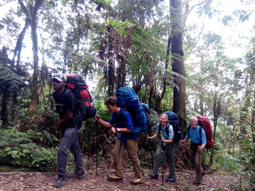



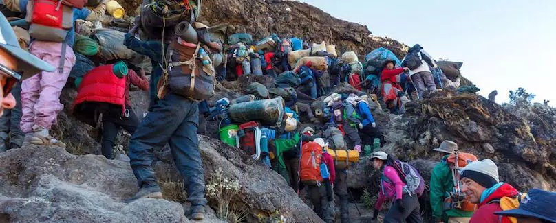

On the climb-high day, a fully laden porter must rise some 700 vertical metres before he can descend to rest. On conventional routes, a tired porter can usually push on or drop back to the last camp and find other parties there.
The Rongai route
The quietest way up Kilimanjaro, from the drier northern side near the Kenyan border. We climb it as TK Rongai, our own variation, developed in 2007 to give the route what the conventional version lacks: a day that climbs high and sleeps low before the summit.
TK Rongai climbs past Mawenzi Tarn and over the ridge, drops to Third Cave, then climbs to School Hut and reaches Uhuru Peak from the north-east, well away from the crowds converging on Barafu. The conventional route crosses the Saddle to Kibo Hut instead. Both come down the Marangu path.
- 68.0–72.2 kmGate to gate
- 6 or 7 daysOn the mountain
- 9.3%Of climbers: the quietest route
- MaranguDescent route
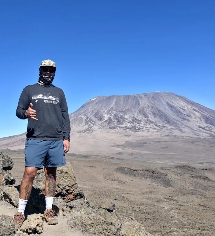
350 mTK Rongai climbs high over the Mawenzi ridge, then sleeps 365 m lower
Why we built our own Rongai
The Rongai route’s great advantage has always been quiet: it is the least crowded way up the mountain. Part of the reason it is so quiet, though, is that on the conventional six- and seven-day schedules its summit success is among the worst of the official routes. Its terrain offers nothing that lets climbers climb high and sleep low, even with a rest day and a modest acclimatisation walk.
Crew who work for operators on the conventional route tell us they typically lose around half the climbing group before the summit.
We refused to schedule groups on Rongai until, in February 2007, we developed our own variation with more climb-high, sleep-low than any established route. Between then and August 2010, 992 climbers used it with us, with success rates well above every alternative.
The conventional Rongai
The route most operators run climbs from Rongai Gate past Simba Camp, Second Cave and Kikelewa to Mawenzi Tarn, beneath Mawenzi’s cliffs, then crosses the Saddle to Kibo Hut, where it joins the Marangu climbers for summit night.
Its walking days are gentle, the camps are quiet and the northern side is drier than the south. But it climbs steadily from camp to camp, with nowhere to go well above the night’s camp and come back down to sleep, so climbers reach Kibo Hut less well prepared for summit night than they need to be.
| Route | Summit success | Climb high, sleep low | Days | Gate to gate | Last night | Summit approach | Crowding |
|---|---|---|---|---|---|---|---|
| TK RongaiTK route | High | 365 m, over the Mawenzi ridge | 6 or 7 | 72.2 km | School Hut4,715 m | From School Hut, on the quiet north-east side | Quiet throughout |
| Rongai | Around halfReported by crews | None | 6 or 7 | 68.0 km | Kibo Hut4,700 m | Gilman’s Point, shared with Marangu | Quiet until Kibo Hut |
Swipe sideways to see every column. Tap i for more detail.
The shape of the route
Drawn from our own GPS tracks. Choose a route to see its profile.
- Rongai Gate2,000 m
- Simba2,640 m
- Kikelewa3,665 m
- Mawenzi ridge4,305 m
- Third Cave3,940 m
- School Hut4,715 m
- Uhuru Peak5,895 m
- Horombo3,715 m
- Marangu Gate1,870 m
The dashed green line marks the climb past Mawenzi Tarn and over the ridge at 4,305 m, before descending to sleep at Third Cave, 3,940 m. Vertical scale is exaggerated about four times, as on any route profile, so slopes look steeper than they feel.
- Rongai Gate2,000 m
- Simba2,640 m
- Kikelewa3,665 m
- Mawenzi Tarn4,300 m
- Kibo Hut4,700 m
- Uhuru Peak5,895 m
- Horombo3,715 m
- Marangu Gate1,870 m
A steady climb from camp to camp to Kibo Hut, with no day that climbs well above the night’s camp. Vertical scale is exaggerated about four times, as on any route profile, so slopes look steeper than they feel.
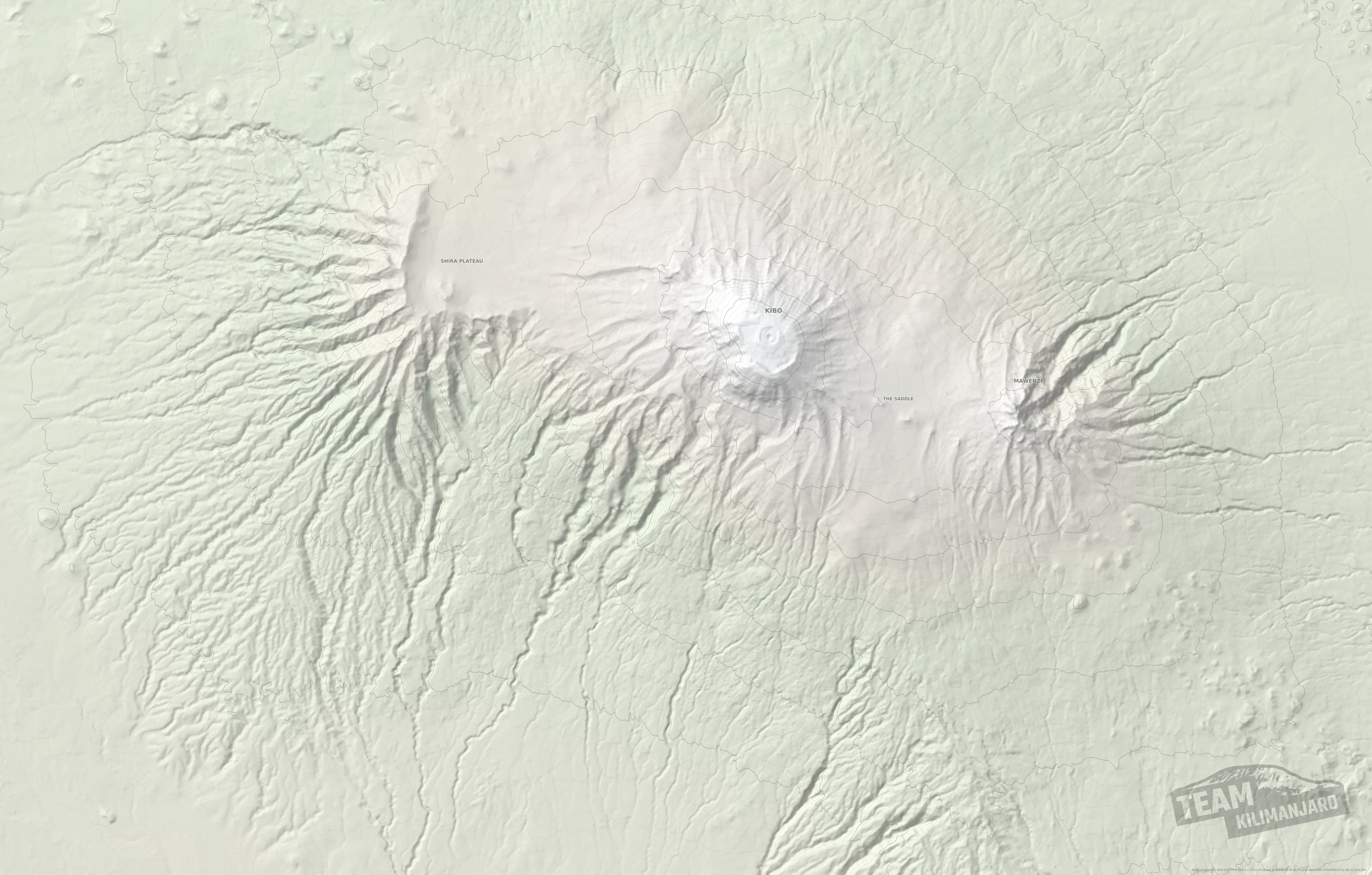
Rongai route map
Both routes on our relief map of the mountain. They share the first two days to Kikelewa, then part. Tap a route’s name to hide or show it, and tap a line for its distance and downloads.
Old Rongai, for climbers already acclimatised. The original and most direct Rongai route climbs from Simba straight to Third Cave and School Hut, and summits from there, 58.6 km gate to gate. It suits climbers who are already acclimatised, for example after summiting Mount Meru a few days before, especially on our Lite and Superlite series, and speed climbers. Tap Old Rongai below the map to show it.
Day by day
Distances come from our GPS tracks. Your guide may vary the plan, as explained below.
- Day1
Rongai Gate to Simba Camp
A gentle start from the gate on the northern side of the mountain, close to the Kenyan border, climbing through the forest edge to the first camp.
- Day2
Simba Camp to Kikelewa
Past Second Cave and onto open moorland, with Mawenzi’s pinnacles ahead. The longest climb of the early days.
- Day3
Kikelewa to Mawenzi Tarn, over the ridge to Third Cave
The day that makes the route. Lunch at Mawenzi Tarn Hut, then over the ridge above it at 4,305 m, the highest point so far, and down to sleep at Third Cave, 365 m lower. This is the climb-high, sleep-low step the conventional route lacks.
- Day4
Third Cave to School Hut
A short day to the high camp, arriving early to rest, eat and drink before the summit night.
- Day5
School Hut to Uhuru Peak, then Horombo
Summit night usually starts around midnight. For young children, who tend to struggle with sleep deprivation in the dark, your guide may choose a dawn start instead. After the summit, a long descent to Horombo.
- Day6
Horombo to Marangu Gate
Down through moorland and rainforest on the Marangu route to the gate, and back to Arusha.
- Day1
Rongai Gate to Simba Camp
A gentle start from the gate on the northern side of the mountain, close to the Kenyan border, climbing through the forest edge to the first camp.
- Day2
Simba Camp to Kikelewa
Past Second Cave and onto open moorland, with Mawenzi’s pinnacles ahead. The longest climb of the early days.
- Day3
Kikelewa to Mawenzi Tarn Hut
Instead of stopping only for lunch, you spend the night at Mawenzi Tarn Hut, beneath Mawenzi’s pinnacles. An extra night at altitude before the high camps.
- Day4
Mawenzi Tarn over the ridge to Third Cave
Over the ridge above the tarn at 4,305 m and down to sleep at Third Cave, 365 m lower: the same climb-high, sleep-low step, after a night to adjust.
- Day5
Third Cave to School Hut
A short day to the high camp, arriving early to rest, eat and drink before the summit night.
- Day6
School Hut to Uhuru Peak, then Horombo
Summit night usually starts around midnight. For young children, who tend to struggle with sleep deprivation in the dark, your guide may choose a dawn start instead. After the summit, a long descent to Horombo.
- Day7
Horombo to Marangu Gate
Down through moorland and rainforest on the Marangu route to the gate, and back to Arusha.
Six days or seven? The routes are identical except for Mawenzi Tarn. On the six-day climb you stop there for lunch, then cross the ridge to Third Cave the same day. On the seven-day climb you sleep at Mawenzi Tarn Hut and cross to Third Cave the next day.
- Day1
Rongai Gate to Simba Camp
A gentle start from the gate near the Kenyan border, through farmland and forest on the drier northern side of the mountain.
- Day2
Simba Camp to Kikelewa
A long, steady climb across open moorland past Second Cave, then towards Mawenzi’s jagged peaks to camp at Kikelewa.
- Day3
Kikelewa to Mawenzi Tarn
A short, steep climb to the tarn beneath Mawenzi’s cliffs, one of the most dramatic camps on the mountain.
- Day4
Mawenzi Tarn to Kibo Hut
Across the Saddle, the high desert between Mawenzi and Kibo, to Kibo Hut, where the route joins the Marangu climbers for summit night.
- Day5
Kibo Hut to Uhuru Peak, then Horombo
Around midnight, up the long scree zig-zags to Gilman’s Point on the crater rim, then along the rim to Uhuru Peak. Back to Kibo Hut, then down to Horombo.
- Day6
Horombo to Marangu Gate
Down the Marangu path through moorland and forest to the gate.
- Day1
Rongai Gate to Simba Camp
A gentle start from the gate near the Kenyan border, through farmland and forest on the drier northern side of the mountain.
- Day2
Simba Camp to Kikelewa
A long, steady climb across open moorland past Second Cave, then towards Mawenzi’s jagged peaks to camp at Kikelewa.
- Day3
Kikelewa to Mawenzi Tarn
A short, steep climb to the tarn beneath Mawenzi’s cliffs, one of the most dramatic camps on the mountain.
- Day4
Acclimatisation day at Mawenzi Tarn
A rest day with a modest walk above the tarn. It helps, but the terrain offers no chance to climb well above the camp and come back down to sleep.
- Day5
Mawenzi Tarn to Kibo Hut
Across the Saddle, the high desert between Mawenzi and Kibo, to Kibo Hut, where the route joins the Marangu climbers for summit night.
- Day6
Kibo Hut to Uhuru Peak, then Horombo
Around midnight, up the long scree zig-zags to Gilman’s Point on the crater rim, then along the rim to Uhuru Peak. Back to Kibo Hut, then down to Horombo.
- Day7
Horombo to Marangu Gate
Down the Marangu path through moorland and forest to the gate.
Shown for comparison. This is the Rongai route as most operators run it. We climb Rongai only as TK Rongai, because the conventional route gives climbers so little chance to acclimatise.
Why your guide may change the plan
Since other operators began copying the route in 2010, we have used several variations of TK Rongai. Your guide chooses between them on the mountain.
What does the guide take into account?
Crowding, water at the camps, your group’s pace and condition, and the weather.
The best variation is not fixed. It depends on the office’s and your guide’s joint assessment of expected crowding at particular camps or sections, how much water is available at the camps planned, the physical condition and pace of your group, and the weather. The aim is the best acclimatisation your group can achieve without exhausting the reserves anyone will need for the summit.
Via Horombo and Barafu
Chosen when the Marangu summit path is congested or water is short at Third Cave.
If crowding on the Marangu route is likely to cause congestion between Hans Meyer Cave and Gilman’s Point, or a dry spell has left little water near Third Cave, your guide may take the group over Mawenzi, descend to Horombo, and approach the summit from Barafu.
Via Horombo, then north to School Hut
Chosen when the western routes are crowding Barafu.
When the western routes, which all converge at or before Barafu, are particularly busy, sometimes with the park asking operators to avoid Barafu, a strong group may still cross Mawenzi to Horombo for the best acclimatisation, then turn north to School Hut.
A gentler day 3, with a longer excursion later
Chosen when a group needs to save energy for the summit.
If the full climb-high day would cost a group reserves it needs for the summit, the guide may shorten it and go straight to Third Cave, water permitting. To make up for it, the group arrives early at School Hut and takes a longer acclimatisation walk towards Hans Meyer Cave, and the guide may move the summit start from midnight to dawn so everyone is properly rested.
Can it fall back to the conventional Rongai?
Only in very rare cases. As far as we can recall, it has happened once.
If a group insists on spending a second day at one camp in the hope that a sick member will recover, the logistics can force a return to the traditional route. We mention it because it is technically possible; as far as we can recall, it has happened only once.
What the route asks of our crew
TK Rongai deliberately goes where other operators do not, which makes it harder work for the people who carry the camp.
Fast teams race on ahead so that food and shelter are ready before lunchtime. Keeping climbers’ exertion and breathing rate down while they acclimatise is the whole point.
We are selective about who joins our core teams. New porters come to us through established staff who are willing to vouch for them and oversee them.
Add a night in the crater
Every route we run, Rongai included, can be lengthened by one day to sleep inside the summit crater at Crater Camp, 5,725 m. This is our Excel Series, and it turns the summit into the start of a day and a half on the roof of Africa rather than a few minutes before the descent.
Our GPS track of the whole crater excursion, every option included: 9.8 km from Uhuru Peak to Stella Point.
- Summitday
Uhuru Peak, Furtwängler Point and down into the crater
From the summit we carry on about 200 m along the rim to Furtwängler Point, then drop into the crater to rest at Crater Camp. Climbers in good form walk to the top of the Western Breach, about 1.0 km there and back, to watch the sun set over Mount Meru, and explore the south face of the Furtwängler Glacier, which is shrinking fast and will not be there much longer.
- Craterday
The Reusch Ash Pit and the Northern Icefields
In the morning we climb to the rim of the Reusch Ash Pit and, if there is time, walk all the way round it. The strongest climbers also explore the Northern Icefields before finishing the circuit. Then on round the rim to Gilman’s Point and down from there.
Not everyone stays the night. Crater Camp is the highest camp on the mountain, and around one climber in five comes down instead of sleeping there, because they feel unwell or because we judge that they are not acclimatised well enough. What happens in the crater always depends on how each climber is, their reserves and their acclimatisation. We sleep in the crater only after reaching the summit, never before it. Excel climbs include the park’s crater camping fee: see Excel prices.
TK Rongai prices
Advantage series, our most popular level of support. Per person in US dollars, depending on the size of your booking group.
TK Rongai, 7 days
From
USD 2,565per person, group of 8
- 2 climbersUSD 2,842
- Solo, joining a groupUSD 2,842
- Solo, private climbUSD 3,329
TK Rongai, 6 days
From
USD 2,240per person, group of 8
- 2 climbersUSD 2,499
- Solo, joining a groupUSD 2,499
- Solo, private climbUSD 2,971
Climbing alone? Join one of our scheduled groups and you pay the same per-person price as two climbers sharing. A private solo climb costs more, and so does a solo booking on dates you choose with fewer than 60 days to go, because there is no time left to fill the climb with others.
Questions about the Rongai route
How long is the Rongai route?
Six or seven days; 68.0 km conventionally, 72.2 km on TK Rongai.
Measured from our GPS tracks, gate to gate, including the descent by the Marangu path. The conventional route is 68.0 km and TK Rongai 72.2 km.
Is the Rongai route quiet?
Yes: it is the least crowded way up the mountain.
On the park’s 2015–16 figures, Rongai carried 9.3% of all climbers. The conventional route joins the Marangu climbers at Kibo Hut for summit night; TK Rongai stays quiet all the way, summiting from School Hut.
Is Rongai the easiest route?
It has the gentlest gradients, but gentle is not the same as easy.
The northern side climbs gradually, which makes the walking days comfortable. But the conventional route gives no chance to climb high and sleep lower, which is why its summit success is low. TK Rongai keeps the gentle gradients and adds the acclimatisation.
Is the north side drier?
Generally, yes.
The northern side of Kilimanjaro gets less rain than the south, which makes Rongai a good choice in the wetter months. It is still worth packing for rain in the forest. Kilimanjaro weather
Where does the Rongai route start?
Near the Kenyan border, on the northern side.
The drive from Arusha takes you round the eastern side of the mountain to Rongai Gate at 2,000 m. Both versions of the route come down the Marangu path on the southern side, so you see the mountain from both sides.
Rongai or Marangu?
TK Rongai, unless you particularly want huts.
Both summit from the eastern side and come down the Marangu path. Marangu uses huts and offers almost no acclimatisation; TK Rongai uses tents and climbs over the Mawenzi ridge to sleep lower before the summit. The Marangu route
What is the Old Rongai route?
The original, most direct Rongai route, for climbers already acclimatised.
From Simba Camp it climbs straight to Third Cave and School Hut and summits from there, then comes down by Kibo Hut and the Marangu path: 58.6 km gate to gate. It is too direct for most climbers, but it suits those already acclimatised, for example after summiting Mount Meru a few days before, especially on our Lite and Superlite series, and speed climbers. You can see it on the map.
Can I download the Rongai routes as GPX or KML?
Yes, all three routes, in both formats.
Use the downloads below the map, or tap a route on the map.
Why climbers trust us with the mountain
2004Guiding on Kilimanjaro since 30 June 2004
97.6%Summit success on our climbs
8The most trekkers we take in one group
2006Led the Western Breach rockfall investigation for the park authority
2007Bernard Goosen’s record wheelchair ascent, in six days, supported by Team Kilimanjaro
2005First women’s speed ascent: Rebecca Nchereri, a TK founder
5 yrsYoungest person ever to summit: Bran Rees-Evans, aged 5 years 136 days
2026First complete ascent from the base, 777 m to 5,895 m, by John Rees-Evans
7Support series, from Superlite to VIP
4Routes of our own design: TK Lemosho, TK Machame, TK Rongai and TK Umbwe
Climb TK Rongai with us
Tell us your dates and group size and we will plan the climb with you, including whether six or seven days suits your group.
Plan my climb