



The Umbwe route
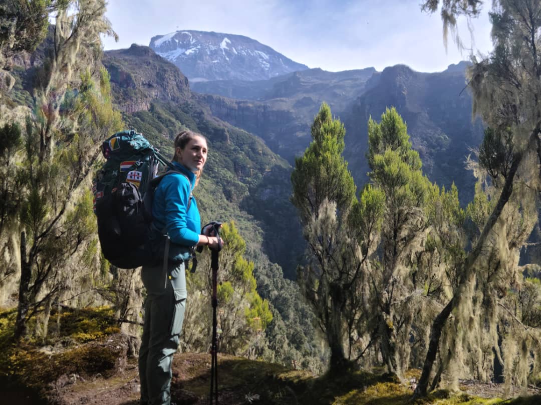
The steepest and most direct way up Kilimanjaro: raw, unkempt and quiet, climbing from the southern forest to Barranco in just two days. We run it as TK Umbwe, our own variation: rare, the most challenging way up the mountain, and almost free of crowds.
From Barranco, TK Umbwe climbs to the Lava Tower to acclimatise, drops to sleep at Moir Hut and follows the quiet northern circuit to summit from School Hut. It is only for strong climbers. Reaching Barranco so quickly means altitude sickness is common on any version of Umbwe, so unless you are already acclimatised, from Mount Meru or another 4,000 m peak, think carefully before choosing it. The standard route over the Barranco Wall to Barafu, and the Western Breach, are below for comparison.
- 67.0 kmTK Umbwe, gate to gate
- 7 daysOn the mountain
- 1,660 mUmbwe Gate
- MwekaDescent route
Three ways to climb Umbwe
All three climb the same steep ridge to Barranco in two days. There they part: TK Umbwe heads up to the Lava Tower and north to Moir Hut, the standard route crosses the Barranco Wall to Barafu, and the Western Breach climbs straight to the crater.
TK Umbwe, our own variation
After one night at Barranco, TK Umbwe climbs back to the Lava Tower for acclimatisation and drops 485 m to sleep at Moir Hut, then crosses the northern circuit to Third Cave in one long day and climbs steadily to School Hut. There is no height lost and climbed again before high camp, and from Moir Hut you will hardly meet another group until the summit. It is demanding: only for strong climbers.
Umbwe by Barafu
From Barranco the route joins Machame, crossing the Barranco Wall and the Karanga Valley to the high camp at Barafu, and summits by Stella Point. We add a rest day at Barafu, and on seven days an extra day at Barranco to climb high and sleep lower, which Umbwe’s fast start badly needs.
Umbwe by the Western Breach
From Barranco the route climbs to camp at the Lava Tower, then Arrow Glacier Camp, and summits by the Western Breach into the crater: dramatic, direct and quiet, and the most dangerous way to the summit. The park has closed it because of rockfall; we have special permission and guide it only with your informed, signed consent.
| Route | Gate to gate | Days | Pace of the climb | Climb high, sleep low | Height lost and climbed again | Last camp | Summit approach | Crowding | Descent |
|---|---|---|---|---|---|---|---|---|---|
| TK UmbweTK route | 67.0 km | 7 or 8 | Barranco on day 2A day sooner than Machame | 485 m, Lava Tower to Moir Hut | None | School Hut4,715 m | From School Hut, on the quiet north-east side | Quiet, except one night at Barranco | Mweka |
| Umbwe | 46.3 km | 6 or 7 | Barranco on day 2A day sooner than Machame | Only with an extra day | About 340 mThe day before summit night | Barafu4,673 m | Stella Point, from Barafu | Quiet to Barranco, then Machame’s camps | Mweka |
| Umbwe via the Western Breach | 42.1 km | 6 | Barranco on day 2A day sooner than Machame | Steady gains, sleeping high | None | Arrow Glacier Camp4,860 m | Western BreachRockfall risk; closed by the park | Quiet after Barranco | Mweka |
Swipe sideways to see every column. Tap i for more detail.
The shape of the route
Drawn from our own GPS tracks. Choose a route to see its profile.
- Umbwe Gate1,660 m
- Umbwe Camp2,965 m
- Barranco3,975 m
- Lava Tower4,645 m
- Moir Hut4,160 m
- Pofu3,990 m
- Third Cave3,940 m
- School Hut4,715 m
- Uhuru Peak5,895 m
- Millennium3,800 m
- Mweka Gate1,645 m
- Umbwe Gate1,660 m
- Umbwe Camp2,965 m
- Barranco3,975 m
- Karanga4,035 m
- Barafu4,673 m
- Uhuru Peak5,895 m
- Millennium3,800 m
- Mweka Gate1,645 m
- Umbwe Gate1,660 m
- Umbwe Camp2,965 m
- Barranco3,975 m
- Lava Tower Camp4,645 m
- Arrow Glacier Camp4,860 m
- Crater5,725 m
- Uhuru Peak5,895 m
- Millennium3,800 m
- Mweka Gate1,645 m
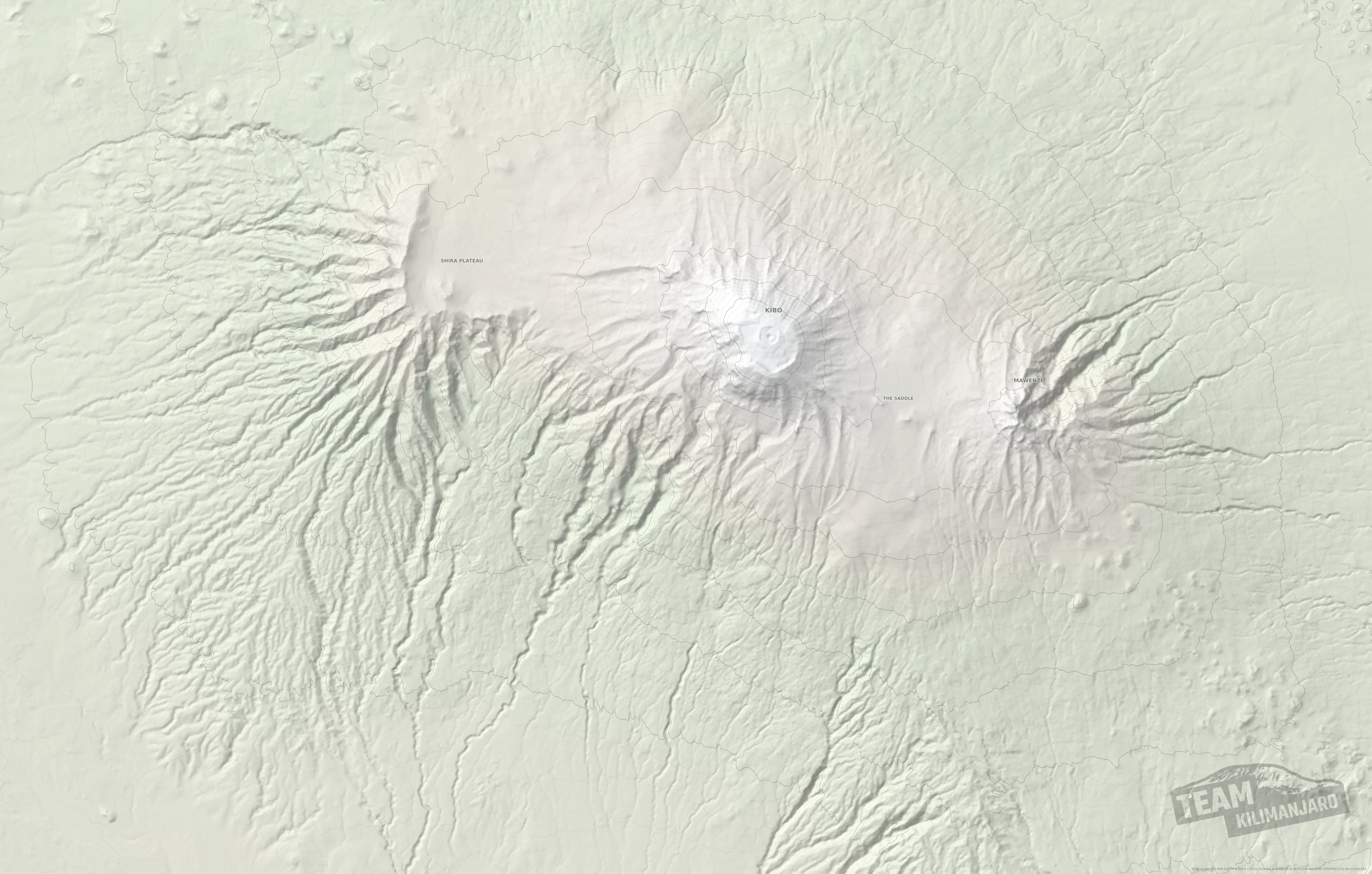
Umbwe route map
All three on our relief map of the mountain. They share the first two days to Barranco, then part. Tap a route’s name to hide or show it, and tap a line for its distance and downloads.
Day by day
Distances come from our GPS tracks. Your guide may vary the plan for crowding, water, your group’s pace and the weather.
- Day1
Umbwe Gate to Umbwe Camp
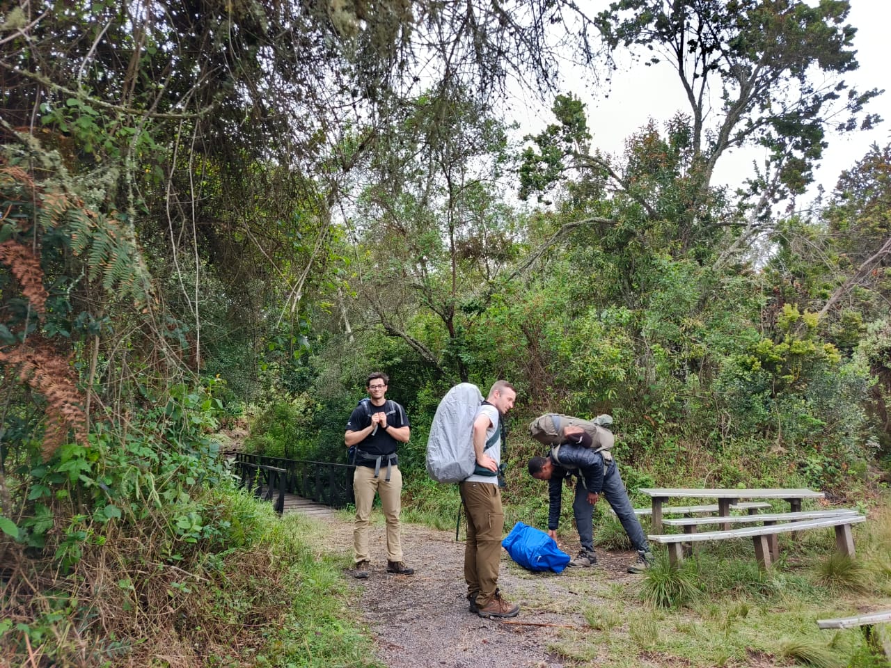
Steep from the start, up a narrow ridge through the rainforest on a raw, unkempt path. You gain more than 1,300 m on the first day.
- Day2
Umbwe Camp to Barranco
Up the ridge, out of the forest and onto open heath, steep almost all the way to Barranco, where Umbwe meets the Machame route. You arrive in two days at a height Machame climbers take three days to reach, so headaches and mild nausea are common, even below 4,000 m.
- Day3
Barranco to Moir Hut, via the Lava Tower
Back up to the Lava Tower, 670 m above Barranco, for lunch and acclimatisation, then north round the western side of Kibo and down to sleep at Moir Hut, 485 m lower and far quieter than the southern camps. From here you are on the TK Lemosho route.
- Day4
Moir Hut to Pofu Camp
Onto the quiet northern side of Kibo, climbing to around 4,400 m before descending to sleep at Pofu, some 400 m lower: climb high, sleep low.
- Day5
Pofu Camp to Third Cave
An easy traverse at almost level height, with Mawenzi’s jagged peaks ahead. A gentle day that lets your body catch up.
- Day6
Third Cave to School Hut
A short, steady climb to the high camp. Rest, an early meal and an early night before the summit.
- Day7
School Hut to Uhuru Peak, down to Millennium Camp
Summit night from the quiet north-east side, usually starting around midnight, to the crater rim and Uhuru Peak around sunrise, then down the southern side to Millennium Camp.
- Day8
Millennium Camp to Mweka Gate
Down through heath and rainforest to the gate, where you sign the summit register, then a short walk to meet our vehicle and the drive back to Arusha.
- Day1
Umbwe Gate to Umbwe Camp
Steep from the start, up a narrow ridge through the rainforest on a raw, unkempt path. You gain more than 1,300 m on the first day.
- Day2
Umbwe Camp to Barranco
Up the ridge, out of the forest and onto open heath, steep almost all the way to Barranco, where Umbwe meets the Machame route. You arrive in two days at a height Machame climbers take three days to reach, so headaches and mild nausea are common, even below 4,000 m.
- Day3
Barranco to Moir Hut, via the Lava Tower
Back up to the Lava Tower, 670 m above Barranco, for lunch and acclimatisation, then north round the western side of Kibo and down to sleep at Moir Hut, 485 m lower and far quieter than the southern camps. From here you are on the TK Lemosho route.
- Day4
Moir Hut over the northern circuit to Third Cave
The longest day, and the reason TK Umbwe is only for strong climbers: onto the quiet northern side of Kibo, climbing to around 4,400 m, past Pofu and on to sleep at Third Cave, with Mawenzi’s jagged peaks ahead.
- Day5
Third Cave to School Hut
A short, steady climb to the high camp. Rest, an early meal and an early night before the summit.
- Day6
School Hut to Uhuru Peak, down to Millennium Camp
Summit night from the quiet north-east side, usually starting around midnight, to the crater rim and Uhuru Peak around sunrise, then down the southern side to Millennium Camp.
- Day7
Millennium Camp to Mweka Gate
Down through heath and rainforest to the gate, where you sign the summit register, then a short walk to meet our vehicle and the drive back to Arusha.
- Day1
Umbwe Gate to Umbwe Camp
Steep from the start, up a narrow ridge through the rainforest on a raw, unkempt path. You gain more than 1,300 m on the first day.
- Day2
Umbwe Camp to Barranco
Up the ridge, out of the forest and onto open heath, steep almost all the way to Barranco, where Umbwe meets the Machame route. You arrive in two days at a height Machame climbers take three days to reach, so headaches and mild nausea are common, even below 4,000 m.
- Day3
Acclimatisation day at Barranco
A day to let your body catch up, with a walk higher towards the Lava Tower and back down to sleep at Barranco: climb high, sleep low, before the push to high camp.
- Day4
Barranco to Barafu, via Karanga
A long, tiring day. First the Barranco Wall, 245 m of scrambling, easier than it looks, with one stride around an outcrop of rock; if you are nervous of it, a member of our crew stands on the ledge below to guide your feet. Then three rises and falls to lunch at Karanga (4,035 m), and 640 m up to the high camp at Barafu.
- Day5
Rest and acclimatisation at Barafu
A day to sleep, eat, drink and recover your reserves, with a short excursion, at your guide’s discretion, no higher than 5,000 m: enough to fine-tune your acclimatisation and see the ridge you will climb that night.
- Day6
Barafu to Uhuru Peak, then Millennium Camp
Summit night starts around midnight, at the time your guide judges best for your pace: up the ridge to Stella Point (5,756 m) on the crater rim, ideally around sunrise, then about an hour more to Uhuru Peak. Back to Barafu for a rest and refreshments, then down to Millennium Camp.
- Day7
Millennium Camp to Mweka Gate
Down through heath and rainforest to the gate, where you sign the summit register, then a short walk to meet our vehicle and the drive back to Arusha.
- Day1
Umbwe Gate to Umbwe Camp
Steep from the start, up a narrow ridge through the rainforest on a raw, unkempt path. You gain more than 1,300 m on the first day.
- Day2
Umbwe Camp to Barranco
Up the ridge, out of the forest and onto open heath, steep almost all the way to Barranco, where Umbwe meets the Machame route. You arrive in two days at a height Machame climbers take three days to reach, so headaches and mild nausea are common, even below 4,000 m.
- Day3
Barranco to Barafu, via Karanga
A long, tiring day. First the Barranco Wall, 245 m of scrambling, easier than it looks, with one stride around an outcrop of rock; if you are nervous of it, a member of our crew stands on the ledge below to guide your feet. Then three rises and falls to lunch at Karanga (4,035 m), and 640 m up to the high camp at Barafu.
- Day4
Rest and acclimatisation at Barafu
A day to sleep, eat, drink and recover your reserves, with a short excursion, at your guide’s discretion, no higher than 5,000 m: enough to fine-tune your acclimatisation and see the ridge you will climb that night.
- Day5
Barafu to Uhuru Peak, then Millennium Camp
Summit night starts around midnight, at the time your guide judges best for your pace: up the ridge to Stella Point (5,756 m) on the crater rim, ideally around sunrise, then about an hour more to Uhuru Peak. Back to Barafu for a rest and refreshments, then down to Millennium Camp.
- Day6
Millennium Camp to Mweka Gate
Down through heath and rainforest to the gate, where you sign the summit register, then a short walk to meet our vehicle and the drive back to Arusha.
- Day1
Umbwe Gate to Umbwe Camp
Steep from the start, up a narrow ridge through the rainforest on a raw, unkempt path. You gain more than 1,300 m on the first day.
- Day2
Umbwe Camp to Barranco
Up the ridge, out of the forest and onto open heath, steep almost all the way to Barranco, where Umbwe meets the Machame route. You arrive in two days at a height Machame climbers take three days to reach, so headaches and mild nausea are common, even below 4,000 m.
- Day3
Barranco to Lava Tower Camp
Back up the path towards the Lava Tower to camp at its foot, 670 m higher than Barranco. A short day by distance, with the afternoon to rest and acclimatise.
- Day4
Lava Tower Camp to Arrow Glacier Camp
A short climb to Arrow Glacier Camp at the foot of the Western Breach, arriving early to rest, eat and sleep, ready to be moving by 05:30 the next morning at the latest.
- Day5
Western Breach to Uhuru Peak, then Millennium Camp
Up the Western Breach, with steep scrambling over rock steps, through the zones exposed to rockfall as quickly as your guide judges safe. Into the crater, then up to Uhuru Peak. Down by Stella Point and Barafu to Millennium Camp. We never sleep in the crater before reaching the summit: it breaks the rule of climbing high and sleeping lower.
- Day6
Millennium Camp to Mweka Gate
Down through heath and rainforest to the gate, where you sign the summit register, then a short walk to meet our vehicle and the drive back to Arusha.
Add a night in the crater
Every route we run, Umbwe included, can be lengthened by one day to sleep inside the summit crater at Crater Camp, 5,725 m. This is our Excel Series, and it turns the summit into the start of a day and a half on the roof of Africa rather than a few minutes before the descent.
Our GPS track of the whole crater excursion, every option included: 9.8 km from Uhuru Peak to Stella Point.
- Summitday
Uhuru Peak, Furtwängler Point and down into the crater
From the summit we carry on about 200 m along the rim to Furtwängler Point, then drop into the crater to rest at Crater Camp. Climbers in good form walk to the top of the Western Breach, about 1.0 km there and back, to watch the sun set over Mount Meru, and explore the south face of the Furtwängler Glacier, which is shrinking fast and will not be there much longer.
- Craterday
The Reusch Ash Pit and the Northern Icefields
In the morning we climb to the rim of the Reusch Ash Pit and, if there is time, walk all the way round it. The strongest climbers also explore the Northern Icefields before finishing the circuit. Then back to Stella Point and down to Barafu.
Umbwe prices
The same price for TK Umbwe and the standard route. Advantage series, our most popular level of support; per person in US dollars, depending on the size of your booking group. The Western Breach costs the same; ask us about its special permission.
TK Umbwe, 8 days
From
USD 2,869per person, group of 8
- 2 climbersUSD 3,135
- Solo, joining a groupUSD 3,135
- Solo, private climbUSD 3,582
TK Umbwe or Umbwe, 7 days
From
USD 2,531per person, group of 8
- 2 climbersUSD 2,772
- Solo, joining a groupUSD 2,772
- Solo, private climbUSD 3,191
Umbwe, 6 days
From
USD 2,205per person, group of 8
- 2 climbersUSD 2,429
- Solo, joining a groupUSD 2,429
- Solo, private climbUSD 2,832
Questions about the Umbwe route
Is Umbwe the hardest route on Kilimanjaro?
It is the steepest and most direct, and the hardest on your acclimatisation.
The trail itself is a steep walk with some scrambling, not a technical climb. What makes Umbwe hard is the pace: it reaches Barranco in two days, a height Machame climbers take three days to reach, so headaches and mild nausea are common even below 4,000 m. Unless you are already acclimatised, your summit chances are considerably lower than on TK Lemosho, TK Rongai or Machame.
Who should climb Umbwe?
Fit climbers who are already acclimatised, for example after Mount Meru.
Umbwe suits climbers who have recently been to around 4,000 m, such as on Mount Meru (4,566 m), and want a quiet, steep, direct way up. If you are coming straight from home, choose a route with more days below 4,000 m, or add the extra acclimatisation day at Barranco.
What is TK Umbwe?
Our own Umbwe: the hardest and quietest way up Kilimanjaro, for strong climbers.
It follows Umbwe to Barranco, climbs to the Lava Tower to acclimatise, drops to sleep at Moir Hut, then follows the quiet northern circuit to Third Cave and School Hut and summits from the north-east. Seven or eight days, 67.0 km: on seven days with one long day of 15.6 km from Moir Hut to Third Cave, on eight days with a night at Pofu between them, as on TK Lemosho. After Barranco you will hardly meet another group until the summit.
How long is the Umbwe route?
67.0 km on TK Umbwe, 46.3 km by Barafu, or 42.1 km by the Western Breach.
Measured from our GPS tracks, from Umbwe Gate to Mweka Gate. TK Umbwe takes seven days; the standard route six or seven; the Western Breach six.
Can I climb Umbwe by the Western Breach?
Possibly: the park has closed it, but we have special permission.
The park closed the Western Breach in May 2025 because of rockfall. We have special permission to use it, and we guide it only with full disclosure of the risks, your signed consent and careful preparation. Ask us for its current status.
How dangerous is the Western Breach?
It is the most dangerous summit approach on Kilimanjaro.
Rockfall killed three climbers there in January 2006, and our founder, John Rees-Evans, led the investigation for the park authority. The risk is greatest between about 5,000 m and 5,300 m, and there is no safe way down in the middle of the climb. The Western Breach and its risks
Can I camp in the crater?
Yes, but only after reaching the summit.
Sleeping in the crater before you have reached the summit breaks the rule of climbing high and sleeping lower, and raises the risk of serious altitude illness. You can camp in the crater after summiting on our Excel series, without using the Western Breach.
Can I download the Umbwe routes as GPX or KML?
Yes, all three, in both formats.
Use the downloads below the map, or tap a route on the map.
Why climbers trust us with the mountain
Climb Umbwe with us
Tell us your dates, your group and whether you are climbing Meru first, and we will plan the climb with you, including whether TK Umbwe suits you.
Plan my climb